There is no doubt that Mount Roraima is one of the most beautiful treks in South America, and it should be part of your bucket list!
This trek is very special because it takes you to an exploration of among the world’s most intriguing landscapes – the summit of the highest tepui.
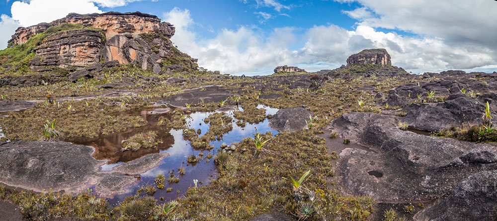
Tepuis are mountains like no other that are made of the oldest rocks on the planet. Their top is flat and they are surrounded by spectacular cliffs. The plateau at the top is an entirely isolated world, full of strange rocks, swamps, lakes and valleys, and it is really fascinating to discover.
I learned from the locals that the name “Roraima” comes from the local Pemon language. Roroi means “blue-green”, and ma means “great” – Mount Roraima is a large mountain appearing blue-green in the distance.
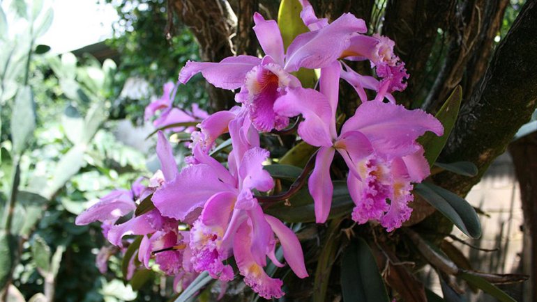
Its flora and fauna are for the most part endemic: they can’t be found anywhere else in the world. Sometimes, a species can even be unique to a specific tepui.
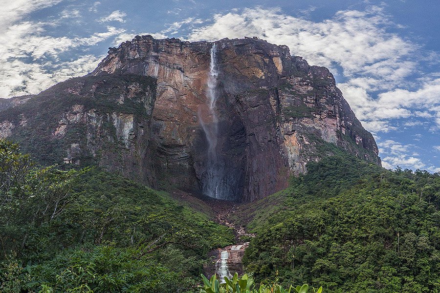
Apart from a few tepuis scattered around Guyana and Brazil that are mostly off-limits to tourists, tepuys can only be found in Venezuela. The world’s highest waterfall, Angel Falls, is also flowing from the top of a Venezuelan tepui. Given the country’s situation, it takes some preparation to travel there but it is still possible. For more information, read: Is it Safe to Travel to Venezuela? My Recent Experience.
I will share here my experience trekking Mount Roraima with tips and tricks I wish I knew before going, and some gear you should bring. After reading this article you should have a good idea of what it all looks like, and don’t miss the virtual tours!
Let’s get started.
Quick Info
GPS (Paraitepuy): 5°3’22.25″N, 60°56’3.90″W
GPS (Base Camp): 5°8’50.23″N, 60°46’53.57″W
How to reach: All treks start from the town of Santa Elena de Uairén, Venezuela. It can be reached by bus from Boa Vista (Brazil). Domestic flights to Santa Elena are mostly discontinued, and the nearest airport in Venezuela is now Puerto Ordaz. Arriving from anywhere in Venezuela, it is safer to use private transport.
Duration of the trek: 6 days or 8 days
Total trekking distance: 80 km / 49.7 miles (for 8 days)
Best season: The dry season runs from December to April. However, on the summit, it rains (very) regularly all year long. I did this trek in late January and had quite a lot of rain.
Can You Climb Mount Roraima and Explore the Plateau by Yourself?
I would like to evacuate a question right from the start – can you hike on Mount Roraima on your own? Well, I usually do all I can to travel on my own, but for Mount Roraima, I would not recommend doing it by yourself. It would be illegal, a guide is compulsory.
Treks to Mount Roraima are managed by the Pemon indigenous community and tourism is an important source of revenue. And honestly, treks to Mount Roraima would be quite complicated to do alone if you consider how much logistics they require.
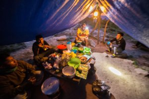
A 6-day or 8-day trek means a lot of food and camping equipment to carry and we had two porters on top of the guide to carry all the stuff around.
On my way to the tepui, I briefly met with a Polish guy who was proud to say he had sneaked in and done the trek without any guide at all. He climbed to the top, explored around a tiny bit, and went back down. Well, I really don’t see the point. This guy has seen nothing of Mount Roraima.
The main purpose of this trek is to explore the top of the tepui, and don’t even think of doing that without a guide because you will inevitably get lost in the vast, rugged and inhospitable environment.
To sum up, you cannot do it alone. Doing it with a guide/agency is the only way you will be able to discover the wonders that Mount Roraima has to offer with all the needed safety, without the hassle of carrying everything and supporting the local economy.
Now that we got this question out of the way, let’s find out more about the trek!
Trekking Mount Roraima: 6 Days or 8 Days?
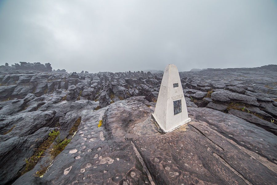
Mount Roraima is split between 3 countries:
The southern half of the tepui is in Venezuela, the northern half is in Guyana, and a small part in the east is in Brazil. The Triple Border “monument” marks the spot where all three borders meet, at the center of the tepui.
All treks to Mount Roraima start and arrive in the village of Paraitepuy, in the middle of the Gran Sabana. The difference between a 6-day trek and an 8-day trek is how much you will explore at the top of the Roraima.
6-day treks seem to be more common and allow you to explore most of the Venezuelian part of the tepui, hike to the Triple Border and spend a night in the Brazilian part. It’s already pretty good but well, I don’t like to do things halfway and wanted to explore the summit as much as possible so I opted for the 8-day trek.
With the 8-day trek, you get to venture into the northern part of Mount Roraima, belonging to Guyana, inside the fascinating tip that is named “La Proa” – The Prow. Unfortunately, you don’t get to go to the very end of the tip because you would need to get passed some kind of canyon that is very unsafe to climb, but you do get to see the largest lake of the aera, the Lago Gladys.
It is a really beautiful region of the summit. It feels (and is) really remote and pristine. I think it’s really too bad to get all the way to the Triple Border only to just walk back and not explore further. For this reason, I obviously recommend the 8-day trek, it is well worth it!
Managing Your Weather Expectations
December to April is the dry season in the Gran Sabana. So indeed, the savanna is very dry at this time of the year and besides, fires occur all the time.
But you have to realize that the summit of Mount Roraima is a world of its own. Isolated from the rest of the world, suspended above the clouds – when not engulfed in them. Mount Roraima is a very humid place.
Going for the trek in the dry season limits the risk and you do have a real chance of having a beautiful blue sky at the top, but you also have a real chance of having rain all along.
I have experienced both situations. I started my exploration of the summit under a beautiful sun, and it was fantastic. The views over the Gran Sabana and to the nearby Kukenan tepuy are unforgettable.
Then came the time to trek into the interior of Mount Roraima. At first, there were some rain showers and the sun would come back, not a big deal. And then it happened. We were hiking in this rugged terrain under a cold, continuous rain. We were drenched, cold and tired. Yeah, that’s not fun at all.
In the next days, exploring the areas belonging to Brazil and Guyana and even later coming back towards Venezuela, we had a lot of rain. In Guyana, the viewpoint of the Prow was almost entirely blocked by the mist. On the way back to Venezuela, we had to skip two of the most beautiful viewpoints because the view was again 100% blocked.
This is the reality of Mount Roraima, you can be lucky or unlucky. And going in the heart of the dry season will not necessarily save you. Luckily, we still had some sunny moments here and there for us to enjoy these incredible, sometimes very colorful landscapes. But it was generally very rainy.
Anyway, I just wanted to write this little paragraph so you can prepare yourself mentally and get in the right frame of mind so you can fully enjoy your discovery of Mount Roraima even if the sky does not cooperate much.
One last thing. I don’t know how much this information is worth but I have heard the guides say that the weather tends to be rainier at the end of a month and the beginning of the next month. So if you are flexible, you can try going in the middle of the month. Who knows!
Mount Roraima Trekking Itinerary (8-Day Trek)
Day 1 – Santa Elena → Paraitepuy → Río Kukenan Camp
- Minivan: 90 km (56 mi), 2.30 hours
- Hiking: 15 km (9.3 mi), 4.30 hours
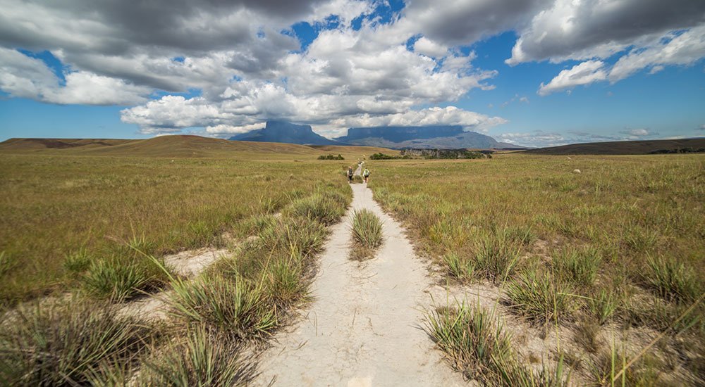
This first day of the trek starts with a 2:30-hour drive from Santa Elena to the village of Paraitepuy. It is from this village that the hike starts.
In the distance, the fascinating Kukenan and Roraima tepuis dominate the horizon. They seem so close and so far at the same time! From this point on, I couldn’t take my eyes off them. They were the target, the obsession.
This first day of the trek is great to discover the scenery of the Gran Sabana (the Great Savanna), covering a large region in southeastern Venezuela.
It’s a pleasant hike with no particular difficulty. You need to cross a few rivers, some of which are pure enough for you to refill your bottle with drinking water – which is not easy to come by nowadays.
VIRTUAL TOUR – Hike From Paraitepuy to Rio Kukenan Camp
First day of the trek from San Francisco de Yuruani and the village of Paraitepuy, crossing the vast landscapes of the Gran Sabana, to the Rio Kukenan Camp. (15 panoramas).
The virtual tour opens in a lightbox. Use your mouse to move around the 360° panoramas.
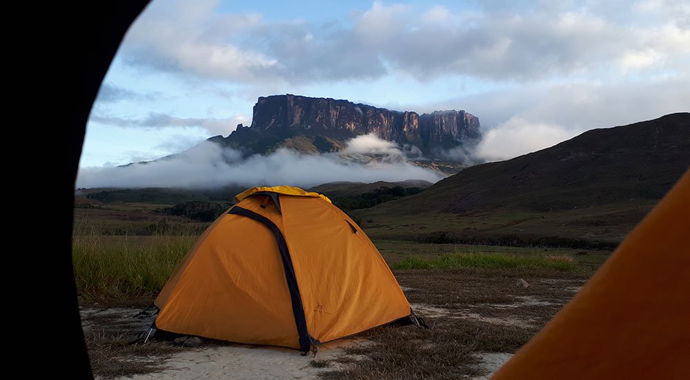
Towards the end of the day, we reached reach our first campsite. The first campsite can either be the Rio Tek Camp or the Rio Kukenan Camp (they are not far apart). I happened to use the Rio Kukenan Camp on the first day and the Rio Tek Camp on the way back.
Both campsites greet you with a beautiful panorama of the Kukenan and Roraima tepuis, and it is easy to find a quiet spot for you to enjoy the sunset over this unique landscape, before going back to camp to enjoy your dinner.
Day 2 – Río Kukenan Camp → Base Camp
- Hiking: 7.3 km (4.53 mi), 3:15-4 hours
At the end of the second day of the trek, you can almost touch Mount Roraima!
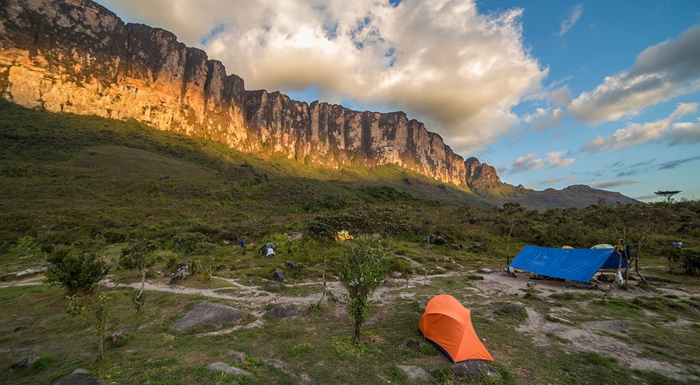
The trail crosses the savanna and slowly gains in elevation to the foot of the tepui where the Base Camp is located. From there, the unobstructed view over the Great Savanna is a most welcome reward.
But of course, you can also appreciate the impressive size of Mount Roraima’s cliffs… and wonder how the heck you will be able to climb that the next day!
VIRTUAL TOUR – Hike From Rio Kukenan Camp to Base Camp
Continue your journey across the Gran Sabana to the base camp, at the foot of Mount Roraima’s spectacular wall. (6 panoramas).
The virtual tour opens in a lightbox. Use your mouse to move around the 360° panoramas.
Having left the Rio Kukenan Camp not long after sunrise, hikers generally reach Base Camp for lunch. The afternoon is free so you have all the time to relax, enjoy the view or explore around. Obviously, I was way too excited to relax and explored around.
VIRTUAL TOUR – Around The Mount Roraima Base Camp
Explore the area around the base camp, with great views over the savanna and the cliffs of Mount Roraima up close. (5 panoramas).
The virtual tour opens in a lightbox. Use your mouse to move around the 360° panoramas.
That night, we had a wonderful starry sky and the tepui’s walls were more or less free of clouds, so I took the chance to shoot a panorama.
It was quite challenging because it was a very dark night with no moon or artificial lights and even with a large aperture lens and a very low shutter speed, it was difficult to get a satisfying result. I had no other choice than to push the ISO, which explains why there is more noise than I would like on the panorama below.
VIRTUAL TOUR – Roraima Base Camp by Night
Starry sky at the foot of Mount Roraima. (1 panorama).
The virtual tour opens in a lightbox. Use your mouse to move around the 360° panoramas.
Day 3 – Base Camp → “Hotel Indio” Camp (Mount Roraima Summit)
- Hiking: 3.2 km (2 mi), 4 hours
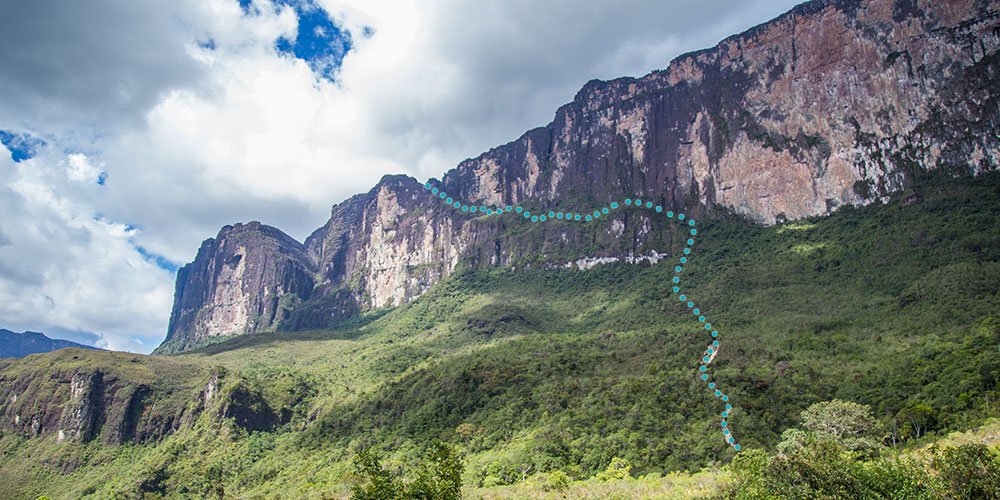
Finally! This day is the day when you get to climb the vertical wall of the tepui and lay eyes on the bizarre landscape at the top for the first time.
Don’t worry, there is no rock climbing involved. You actually follow a path that climbs along the cliff, all the way to the top. I have to say though, that the path is at times very steep, particularly the first part before reaching the cliff itself. You can see it by yourself in the virtual tour below.
VIRTUAL TOUR – Hike From Base Camp to The Summit of Mount Roraima
Climb the steep slope and follow the ridge on Mount Roraima’s cliff, all the way to the top (12 panoramas).
The virtual tour opens in a lightbox. Use your mouse to move around the 360° panoramas.
Along the cliff, the path is clean and relatively easy to follow; and it is interesting to see the vegetation change as you are climbing.
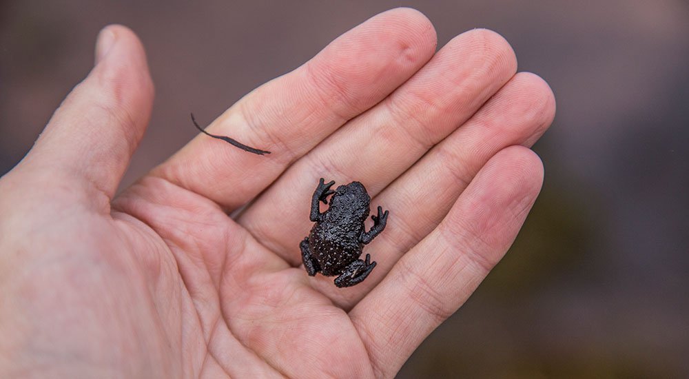
At first, you cross a lush palm tree forest, and you are so close to the cliff that you can touch it. Later, closer to the top, the path gets really rocky and quite steep, and you begin to see the typical flora and fauna of the tepuis such as the Roraima black frog.
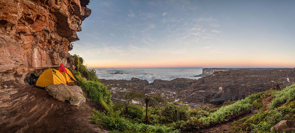
Once at the top, you are immediately immersed in the strange world of Mount Roraima. Camps on the summit of the tepui are nicknamed “hotels”, they are located under overhang rocks or in caves, where you can hope to stay dry even if it rains. The camp I used is called Hotel Indio.
VIRTUAL TOUR – The “Hotel” Indio Camp
Discover the first campsite on top of Mount Roraima. (2 panoramas).
The virtual tour opens in a lightbox. Use your mouse to move around the 360° panoramas.
You get a whole afternoon to immerse yourself in the amazing scenery around camp, made of bizarre rock formations, small lakes and lagoons, and untouched swampy patches of delicate vegetation that look like mini Japanese gardens.
It’s a real delight for anyone who has ever dreamed of being an explorer!
VIRTUAL TOUR – Exploring Around Camp
First exploration of the unique landscapes on the top of Mount Roraima. (8 panoramas).
The virtual tour opens in a lightbox. Use your mouse to move around the 360° panoramas.
In the evening, for sunset, our guide took us to a huge rock called Maverick Rock (not far from camp), which is no less than the highest point on Mount Roraima – itself the world’s highest tepui. The view of the Gran Sabana below is unforgettable.
VIRTUAL TOUR – Maverick Rock, Highest Point on Mount Roraima, and All Tepuis
Climb to the highest point on Mount Roraima, the highest of all tepuis. (3 panoramas).
The virtual tour opens in a lightbox. Use your mouse to move around the 360° panoramas.
Day 4 – “Hotel” Indio Camp → Coati Cave Camp (Brazil)
- Hiking: 10 km (6.25 mi), 5 hours
On the 4th day of the trek, you really start exploring the interior of the plateau at the top of the tepui. But before leaving, look at this fantastic sunrise, over a sea of clouds, far from the world.
VIRTUAL TOUR – Sunrise on Mount Roraima
Wonderful sunrise from the heights of Mount Roraima, near the “Hotel” Indio Camp. (1 panorama).
The virtual tour opens in a lightbox. Use your mouse to move around the 360° panoramas.
It is now time to hike to the center of Mount Roraima – the Triple Point, where the Venezuela, Brazil, and Guyana borders meet.
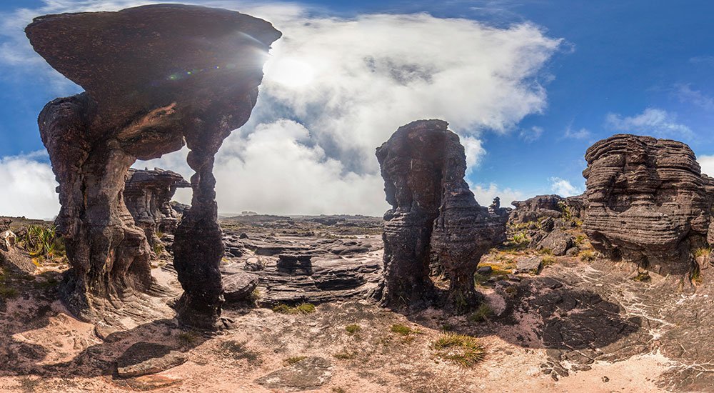
En route, you will be able to really gauge the immensity of the tepui, crossing rivers and valleys, and walking past rocks with the most unimaginable shapes. Sometimes, you will see boulders weighing several tons precariously stacked on top of each other, wondering how on earth it is possible that the whole thing is not crashing to the ground.
VIRTUAL TOUR – Hike From Indio Camp to The Triple Point
Start trekking into the summit of Mount Roraima, to La Fosa (The Pit) and the Triple Border (Venezuela/Brazil/Guyana). (9 panoramas).
The virtual tour opens in a lightbox. Use your mouse to move around the 360° panoramas.
Today’s campsite is really cool. The Gruta do Coati (Coati Cave) is named after an elusive mammal that roams around the summit of Mount Roraima, which looks like a long-nosed raccoon. I spotted one during my trek for a couple of seconds as it was running away. They are pretty hard to spot.
But let’s get back to that cave. It’s actually a cave and a huge crack in a rock formation, with plenty of space to pitch the tents and have a proper kitchen corner. The cave is located in the Brazilian part of Mount Roraima.
VIRTUAL TOUR – Gruta do Coati (Brazil)
Discover the amazing Coati Cave on the Brazilian side of Mount Roraima, that we used as a second camp on the tepui. (5 panoramas).
The virtual tour opens in a lightbox. Use your mouse to move around the 360° panoramas.
An easy 10-minute walk from the cave is enough to reach the edge of the tepui, where a stunning view is awaiting you. Right in front of you, the small Wei-Assipu tepui towers above sprawling rainforests. Turn your head to the right, and you can spot the Venezuelan savannas in the distance.
VIRTUAL TOUR – Viewpoint to Tepui Wei-Assipu (Brazil)
Not far from the Coati Cave, enjoy the view of the small Wei-Assipu tepui in Brazil, often nicknamed “Little Roraima”. (1 panorama).
The virtual tour opens in a lightbox. Use your mouse to move around the 360° panoramas.
Day 5 – Hike to Lago Gladys & La Proa (Guyana) – Tip of the Roraima Tepui
- Hiking: 4.4 km (2.7 mi), 2 hours each way
At this point, those on the 6-day trek will already head back to the Venezuelan side and prepare to hike back down. But since I was on the 8-day trek, I had the opportunity to discover the Guyanese part of the tepui.
This part is a little more off the beaten track, and I can’t explain why but it felt so. I feel that this hike is one of the most beautiful and memorable of the whole trek.
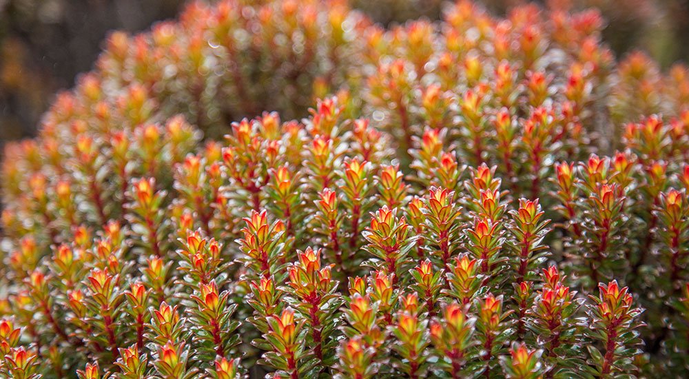
The landscape is marked by an abundance of Bonnetia shrubs and their bright orange leaves, making the landscape more colorful than in other areas – particularly when the sun is shining.
For a part of this hike, you follow a river that is one of the sources of the powerful Essequibo River, the main river of Guyana and one of the largest rivers in South America. Quite amazing to think about that, while looking at this pretty little stream of crystal-clear water here at the top of Mount Roraima.
VIRTUAL TOUR – Hike From Coati Cave to Lago Gladys & La Proa (Guyana)
Venture deep into the northern region of Mount Roraima, belonging to Guyana. Explore all the way to Lake Gladys and almost to the tip of La Proa (The Prow), following a colorful valley. (17 panoramas).
The virtual tour opens in a lightbox. Use your mouse to move around the 360° panoramas.
Near the northern end of the tepui, Lake Gladys suddenly appears among the clouds. It is larger than I had expected, at the bottom of a large depression. So you can’t actually touch it, you can just look at it from above.
The landscape around the lake is very rocky and very empty; it feels inhospitable and fascinating at the same time. You can take a look by yourself with the virtual tour above.
Day 6 – Coati Cave (Brazil) → “Hotel” Uno Camp (back to Venezuela)
- Hiking: 10 km (6.3 mi), 5 hours
Our exploration of the Brazilian and Guyanese parts of the tepui is over and it is now time to get back to the Venezuelan side, taking a different path.
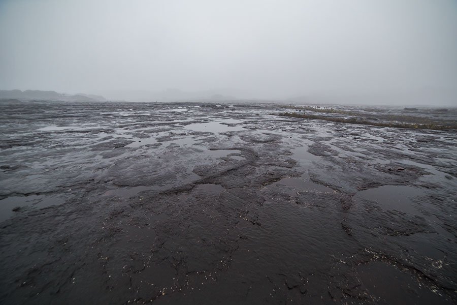
A major landmark that you discover during this hike is the Valley of Crystals. I had heard of this place before the trek and I wasn’t sure what I would find. Well, the pretty pink sand on the ground gives way to an incredible accumulation of crystals.
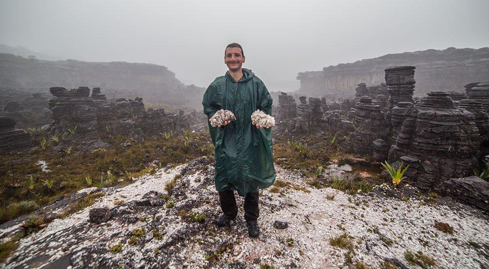
Sadly, I had to discover this natural wonder under the rain, but it was still pretty astonishing. After all, it’s not every day you can say “Hey buddy, I have walked on a carpet of crystals today!”
VIRTUAL TOUR – Hike to the Valley of Crystals & Back to the Venezuelan Side
Leave the Coati Cave and trek back south to the Venezuelan side of Mount Roraima, passing through the mythical Valley of Crystals (8 panoramas).
The virtual tour opens in a lightbox. Use your mouse to move around the 360° panoramas.
Back to the same area where we arrived at the top of the tepui on the third day of the trek, I got to camp in another spot called Hotel Uno.
Day 7 – “Hotel” Uno Camp → Río Tek Camp (Back Down)
- Hiking: 12.4 km (7.7 mi), 5:30-6 hours
In the morning, we took an easy 30-40 min walk to a place nicknamed Los Jacuzzis: deep lagoons of crystal-clear – and freezing-cold water where the brave can bathe. On the way there, we crossed a surprising area consisting of a vast expanse of pink sand: el Campo de Golf (the Golf Course).
We were also supposed to stop at two spectacular viewpoints but with this weather… there was no point to go because the view would have been all blocked anyway. Too bad.
VIRTUAL TOUR – Hike to the Campo de Golf & Los Jaccuzis
On the Venezuelan side, go visit the pink sands of the Campo de Golf (the Golf Course) and the deep and clear waters of Los Jacuzzis, before trekking back down the tepui (2 panoramas).
The virtual tour opens in a lightbox. Use your mouse to move around the 360° panoramas.
Unfortunately, all good things come to an end! So it was time to walk back down, Sad to leave but happy to have had the privilege to be there.
Being slightly annoyed by the rain and the cold couldn’t erase the feeling of wishing I could have stayed and explored more of this incredible mountain.
It was so rainy at the top of the tepui that on the way down, giant waterfalls were flowing from the edge of the cliffs, making us more drenched than we already were. Once back at the Base Camp, we had our lunch snack and kept going until we reached the Rio Tek Camp where we all spent the night.
Day 8 – Río Tek Camp → Paraitepuy → Santa Elena
- Hiking: 13.2 km (8.2 mi), 5 hours
- Minivan: 2 hours + Lunch Break
As soon as I opened my tent in the morning, the majestic Kukenan tepui was there to greet me and remind me how lucky I was to discover this part of the world.
This last day is not very hard. After a good breakfast, you just walk back to what you walked on the first day. It is the opportunity to enjoy one last time being immersed in the vast scenery of the Gran Sabana.
After reaching Paraitepuy, a pick-up from the agency was there to take everyone for a delicious grilled chicken lunch in the village of San Francisco de Yuruani, located on the main road that led us back to Santa Elena.
And it was the end of this fabulous adventure!
What to Bring and Wear for The Trek to Mount Roraima
Hiking on Mount Roraima is not really a walk in the park. Taking the right gear and wearing the right clothes will dramatically improve your experience!
Let’s start with some basic gear that you should pack for your trek.
- The first one is pretty obvious, make sure you have a strong hiking backpack. I recommend a medium size like 50 liters. It needs to be large enough to carry your warm clothes, which often take up a lot of space.
- You can probably do without it but it may be convenient to also bring a small backpack to put your camera and water bottle in when you go for a hike on the summit and go back to the same campsite. You can carry it around in your larger backpack and just take it out when you need it.
- All along the trek you will be camping. Camping gear such as tents, sleeping bags, cooking gear… will be provided by your travel agency but one thing you should not forget to bring is a reliable headlamp.
- If you are into that, it could be a good idea to take a handheld GPS device to track your itinerary, especially on top of the tepui. This way, when you get back home, you’ll be able to see what parts of the tepui you have explored!
What you wear during the trek is also extremely important. The weather on Mount Roraima is often challenging and the terrain is rugged, rocky, and swampy.
- The first thing you need is good waterproof hiking shoes. I recommend hiking boots rather than simple hiking shoes, to be sure your ankles are well-supported and protected.
- Another thing that was a real lifesaver for me is a rain poncho. If you are unlucky enough to have as much rain as I did, I would rely on a rain poncho rather than a normal rain jacket alone. A poncho can also keep your backpack dry.
- I recommend taking a good fleece jacket to keep you warm. It can get very chilly at the top, and the feeling is worse with the high humidity.
- Take 2 or 3 hiking pants (especially if you go for the 8-day trek), in case you get caught in the rain
- Don’t hesitate to take extra socks and T-shirts to make sure you will always be able to change for a dry one in case you get wet.
This gives you a few ideas of useful things to bring on your Roraima trek in order to fully enjoy the experience no matter what weather you get.
Virtual Tour Map
Unfortunately, there is a shift in the Google Maps images of Mount Roraima and the position of some marks doesn’t coincide with the real position on the image. But it still gives you a good idea of the itinerary of this trek, both on the Great Savanna and at the top of the tepui.
TRAVEL MAP – Mount Roraima Trek in Canaima National Park
Visualize on the map the precise locations of panoramas in the virtual tour and places of interest to help you prepare for your trip to the Roraima Tepui.
The map opens in a lightbox. Zoom in to explore!