One more step. One more step. Struggling my way up the final slope of Tunari Peak, I was more determined than ever, and at the same time wondering if my heart was going to explode.
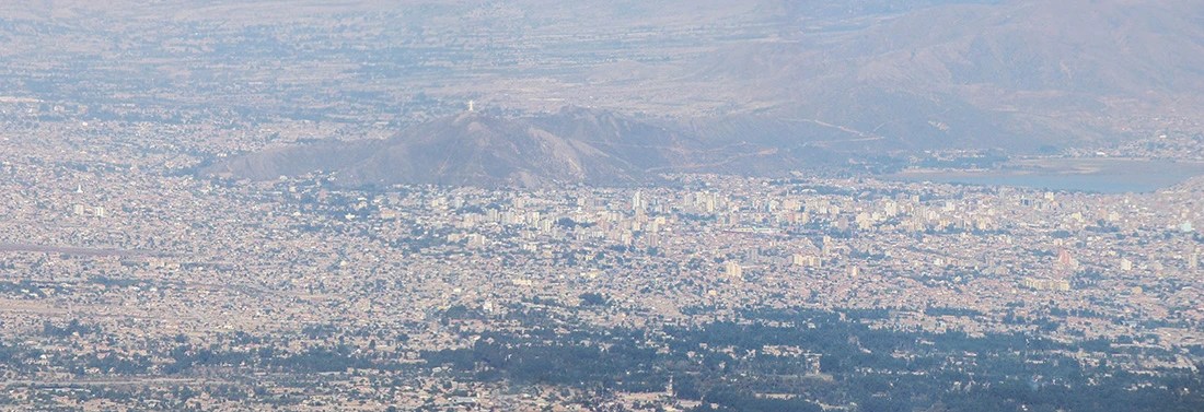
Flashback 24 hours. As I was visiting Cochabamba and planning what to do next, I knew I wanted to go to Torotoro National Park but I found myself with a couple of days with nothing to do, and I don’t like having anything to do. I could just have wandered aimlessly in the city but I knew I could do better than that.
I came across this guy owning a small travel agency and asked him for suggestions. He said since I enjoy going out in the wild, he could drive me and guide me to the Tunari Peak. I must admit I had never heard of this mountain before, but it sounded exciting. I had already spent a few days in the region of Cochabamba and was fairly well acclimatized to the altitude so… why not!
That day, I broke my altitude record and passed the 5,000 m mark for the first time in my life. And it was not without difficulty! But in any case, it was a great experience and I am happy to share my tips on how you can do the same. So… Fancy a high-altitude hike? Read on!
Quick Info
GPS (Summit): 17°17’9.97″S, 66°23’35.37″W
How to go: With a guide or on your own from Cochabamba
Price: 700-750 Bolivianos ($100-110)
Duration of the hike: Around 5 to 6 hours up and down.
Maximum altitude: 5,035 m / 16,519 ft
Best season: Possible all year long.
Some Facts About The Tunari Peak and Tunari National Park
At 5,035 m / 16,519 ft above sea level, the Tunari Peak, or Cerro Tunari is the highest mountain in the Department of Cochabamba in central Bolivia. It is part of the Cordillera Tunari mountain range, protected by the Tunari National Park.
The national park was created in 1962 and protects 309,000 hectares of Andean landscapes around the Cerro Tunari.
The climate in the area is quite dry, with less than 600 mm of rain per year. However, the national park is home to several hundred lakes, rivers, and Andean swamps called bofedales, which are an important source of water for the city of Cochabamba.

Can You Do The Cerro Tunari Hike Alone?
Technically, there is nothing preventing you from doing this hike on your own. In order to do that, you would need to take public transport to Quillacollo, the west suburb of Cochabamba, and another public bus towards Morochata and get off when you are near the mountain. Of course, it is by far the cheapest option, probably no more than $4 or $5 go and back. You could also take a taxi from Quillacollo to the start of the trail. But make sure you will be able to find buses to come back to Cochabamba.
The trail to the top of the Tunari Peak passes by two lakes. At first, the trail is pretty obvious but after the second lake, there isn’t much of a trail anymore. So you need to find your way through the boulders towards the top. Not too obvious, but doable. Check out the map further down this page to see what path I followed to the top.
That said, I would really advise against doing this hike all alone. Even if you really don’t want a guide, at least go with someone. Many things can go wrong at this high altitude and difficult terrain, and it is always possible to get lost in the mountains as well.
Tour groups are not fun, I agree. So in my opinion, the best way is to do what I did. Just you and a guide. The guide conveniently drives you to the trailhead, guides you in the mountains, and is there to help in case anything happens. Go around a few travel agencies in Cochabamba and ask. Sometimes, the boss can just take you there if he has a free day. That’s what happened to me. You can also ask the hotel or guesthouse you are staying in. These guys often have many contacts to organize private tours easily, and not necessarily very expensive.
This way, you also avoid the headache with public transport and you stay safe.

Hiking The Tunari Peak: What To Expect
This is a beautiful but challenging hike across the mountains starting at about 4,400 m / 14,400 ft above sea level, which is already a pretty big altitude gain from Cochabamba down in the valley at 2,574 m / 8,445 ft. It means that from the start of the hike to the top of Cerro Tunari, you will gain another 600 m / 2000 ft or so in elevation.
As I mentioned before, the path runs past two mountain lakes with crystal clear water, which are the two jewels of this hike. They are like two blue gems standing out in an otherwise more colorless landscape.
My guide was referring to the first lake as Laguna Macho, and the second lake as Laguna Turu, whereas Google Maps gives no name to the first lake and refers to the second lake as Laguna Macho. I don’t know who is right, but I tend to trust the local knowledge a bit more.
Anyway, being in the heart of Tunari National Park, you also have a good chance of seeing typical Andean fauna. I was lucky enough to see a small herd of vicuñas and llamas. As for plant life, I was excited to come across the amazing Caiophora chuquitensis, with not only thorny stems and leaves, but also bearing thorny flowers! Have you seen a thorny flower before?


The path itself is very rocky and with a lot of gravel. After passing the second lake, there isn’t much of a trail anymore and you are just walking among boulders and up long slopes. Depending on the season, you might have to walk in the snow. I climbed the Tunari Peak in July and it was all dry. Only small bits of everlasting snow remained in the shaded areas.
I like the fact that my guide made me make a loop, taking a different way to go up and to go down. Since there is no clear, official trail up the moutain, it seems that you can basically create your own climbing route – just don’t get lost! On the way up, I hiked more into the mountains, and on the way down I hiked along the Laguna Turu.
The hike takes 2:30 to 3 hours up, and about 2 hours down. Can be a little less or a little more depending on your level of fitness and how well you are acclimatized.
VIRTUAL TOUR – At The Top of Cerro Tunari
Stand at the top of the Tunari Peak at 5,035 m / 16,519 ft above sea level, and enjoy the view to the Tunari Cordillera and the Cochabamba Valley. (1 panorama).
The virtual tour opens in a lightbox. Use your mouse to move around the 360° panoramas.


Cerro Tunari Hike: The Altitude Challenge
The terrain is very rocky but not particularly difficult, the true challenge of this hike is of course the altitude. Reaching 5,000 m or 16,400 feet is no easy feat. I have done a number of high altitude hikes in the 3,000 or 4,000 m, but the Cerro Tunari Hike takes the difficulty one step further.
The first half of the hike is fine if you are properly acclimatized, but towards the end, it gets really difficult. I was telling myself OK, one more step. And again, one more step. My body was exhausted, but the summit was so close that there was no way I would turn back down before reaching it. My heart was beating very strongly and fast, trying to make up for the lack of oxygen.
It is absolutely critical that you attempt this hike only if you are well acclimatized to the altitude.
→ Make sure to read our advice for preparing and hiking in high altitude.
At this altitude, the weather is often difficult at well. When I could finally stand on the top of the mountain, a fabulous 360-degree view was there to welcome me, and so was a constant, strong icy wind. In such conditions, we couldn’t stay at the top for too long.


What To Bring On Your Hike To The Tunari Peak
- Good hiking boots – My preference goes to hiking boots instead of hiking shoes for the extra support and protection for your ankles, useful in a rocky terrain.
→ You can check our guide to the best hiking boots under $100 if you need a new pair. - A small backpack to put snacks and water, why not equipped with a hydration bladder. The air is very dry at altitude and it’s important to stay well hydrated.
- Quality snacks such as energy bars.
- Sun protection & lip balm
- A warm, wind-breaking coat and a good hat to cover your head and ears. Gloves.
TRAVEL MAP – Cerro Tunari Hike
Visualize on the map the path I took to climb the Tunari Peak and the points of interest to prepare for your trip to the Cerro Tunari.
The map opens in a lightbox. Zoom in to explore!
Final Thoughts
The Tunari Peak really is a great, accessible opportunity to tackle high-altitude hiking. A couple of driving hours away from the city of Cochabamba, you can be totally immersed in the wild landscapes of the Andes, and meet the local fauna and flora.
I hope this article was valuable to you in order to prepare for your Cerro Tunari hike, or that at least, it inspired you to do it!


